

Introduction
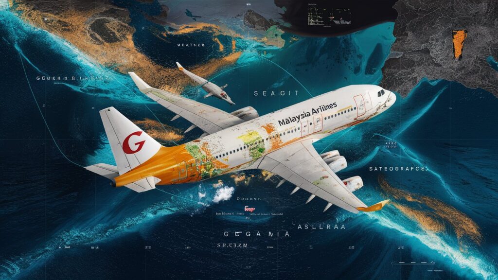
The disappearance of Malaysia Airlines Flight MH370 in 2014 remains one of aviation’s greatest unsolved mysteries. Despite extensive search efforts across the Indian Ocean, the Boeing 777 and its 239 passengers and crew have never been conclusively located. Over the years, amateur sleuths, researchers, and journalists have turned to digital tools like Google Maps to scour satellite imagery for potential clues. This article delves into how Google Maps has become an unexpected platform for theories, investigations, and public curiosity about MH370. We’ll explore key search areas, debunk myths, and analyze the intersection of technology and tragedy in the quest for answers.
1. The Role of Satellite Imagery in the MH370 Search
Satellite data played a critical role in official investigations, narrowing the search zone to the southern Indian Ocean. While agencies like Inmarsat analyzed radar and satellite pings, public interest surged in using Google Maps coordinates to scan remote regions for debris or wreckage. Enthusiasts have combed through historical imagery, zooming into ocean surfaces and islands like Réunion, where confirmed debris washed ashore in 2015. However, the vastness of the ocean and limitations in image resolution often lead to false alarms. This section examines how satellite technology—both professional and crowdsourced—shaped the search narrative and why Google Maps became a symbolic tool for amateur investigators.
2. MH370 Conspiracy Theories and Google Maps “Discoveries”
The absence of concrete answers has fueled countless conspiracy theories, many amplified by Google Maps anomalies. Users claim to spot debris fields, intact fuselages, or even the plane’s shadow in shallow waters. For instance, coordinates near Cambodia’s Cardamom Mountains or the Maldives sparked viral posts, though experts dismissed these as pareidolia—the tendency to see patterns in random data. This section dissects popular theories, highlighting how low-resolution imagery and optical illusions create misleading “evidence.” It also addresses the ethical implications of spreading unverified claims, which can distress victims’ families and distract from credible research.
3. Crowdsourcing the Search: How Google Maps Empowers Public Participation
Platforms like Google Maps democratize investigative efforts, allowing anyone with an internet connection to join the search. Projects such as TomNod (a crowdsourcing initiative) utilized satellite imagery to identify potential debris, though none led to breakthroughs. Similarly, social media groups share coordinates and collaborate on analyzing suspicious shapes in the ocean. While these efforts reflect collective empathy, they also underscore the challenges of verifying findings without professional expertise. This section explores the balance between public engagement and the need for scientific rigor in high-stakes investigations.
4. Limitations of Google Maps in Solving Aviation Mysteries
Despite its utility, Google Maps has inherent limitations. Satellite images are often outdated, lack the resolution to distinguish small objects, and cannot penetrate ocean depths. The MH370 search required specialized sonar and underwater drones, tools far beyond the scope of consumer-grade mapping software. Furthermore, cloud cover, lighting conditions, and ocean currents complicate visual analysis. This section critiques the overreliance on digital cartography for solving complex mysteries, emphasizing that while technology aids awareness, it cannot replace physical exploration.
5. The Legacy of MH370: Technology, Transparency, and Trauma
The MH370 tragedy reshaped aviation safety protocols, including real-time tracking mandates for commercial flights. It also highlighted the public’s hunger for transparency, with platforms like Google Maps serving as both a resource and a canvas for speculation. For families of the victims, the unresolved nature of the disappearance compounds their grief, as viral “discoveries” periodically revive false hope. This section reflects on how technology intersects with human emotion, urging respect for factual inquiry while acknowledging the limits of digital tools in resolving profound losses.
Conclusion
The search for MH370 Malaysia Airlines on Google Maps symbolizes humanity’s relentless drive to solve mysteries, blending cutting-edge technology with grassroots curiosity. While the platform offers a unique lens for exploration, it also reminds us of the gaps between digital speculation and physical reality. As advancements in satellite imaging and AI continue, future investigations may benefit from more precise tools—but for now, MH370 remains a haunting enigma. The tragedy underscores the need for humility in the face of nature’s vastness and the enduring importance of empathy for those left seeking closure.
Frequently Asked Questions (FAQs)
Q1: Are there specific Google Maps coordinates linked to MH370?
A1: No verified coordinates pinpoint the aircraft. Claims about locations near Cambodia or the Indian Ocean are based on unverified imagery and have been debunked by experts.
Q2: Can I find MH370 wreckage using Google Maps?
A2: Unlikely. The ocean’s depth, image resolution limits, and outdated satellite data make it improbable for casual users to identify debris.
Q3: Why do people believe they see MH370 on Google Maps?
A3: Pareidolia—a psychological phenomenon where humans perceive meaningful shapes in random patterns—explains most “sightings.”
Q4: Did authorities use Google Maps in the official search?
A4: No. Professional teams relied on sonar, underwater drones, and satellite data from specialized providers, not consumer platforms.
Q5: How has MH370 influenced aviation technology?
A5: The incident spurred reforms, including real-time flight tracking and improved emergency locator beacons to prevent similar mysteries.
This article merges historical context, technological analysis, and ethical considerations to provide a comprehensive look at MH370’s digital footprint.
